Cycle/Skate/Ped Mapmaker
 (click on pictures to enlarge. -
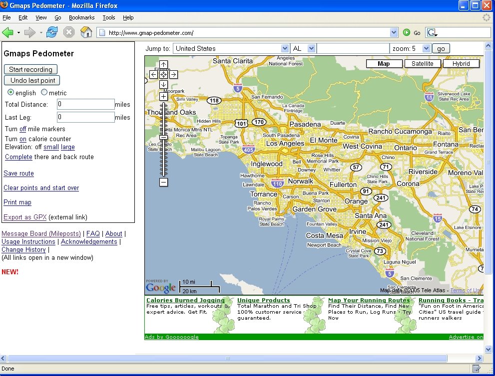
1) Gmap-Pedometer webpage.
2) LA Acura Bike Tour route map-using Gmap-Pedometer.
3)Elevation guide of LA Bike Tour route using Gmap-Pedometer)
[see also the Santa Monica Bicycle route map project and map]
Check out the "Gmap-Pedometer". This is an awesome online map tool for cyclists, skaters, and Peds.
The Gmap-Pedometer is a hack for the powerful Google maps engine.
It was designed by a runner who wanted to be able to easily know how far they had run, without having to carry a GPS with them.
The nice thing, perhaps unintended, is that this hack for Google Maps is also great for measuring the distance, and route ,creation and sharing, for cyclists and skaters as well.
The hacker added an "elevation" guide, so you can know how steep your route is along the entire length.
This is nice for cyclists whom want to find a route that avoids steep hills. And I suppose it may be great for those cyclists who are training for the Tour De France and need to find a good climbing hill.
It also includes a "calorie" counter. I am not sure how that is mearsured. And I think that is probably for runners specifically.
Skaters might like using this hack to create routes to skate on. They could use it just as cyclists and runners to come up a route that meets their needs. They may want to pick a route which avoids the steep hills. Or they may like to find a route that has a steady mild decline.
This could be usefull for tailering a multimodal trip as well.
A person could pick a route to cycle, skate, walk, along with buses, which avoid having to pedal, skate, walk up the hill, and pick a route that is level or downhill to to the bus/train stop.
And because this hack uses the powerful google map, you can easily zoom in and out to get perspective of your route. And you can grab and move the map around
At the right is a map created for the LA Acura Bike Tour route map (2006). It was created using Gmap-Pedometer. The picture below is what the elevation guide for the Bike Tour route looks like. Notice that there is a mile marker for the entire route on the map, as well as the route elevation guide. The elevation guide also includes the number of feet scale, above sea water, on the left.
Take a look at the Gmap-Pedometer LA Acura Bike Tour route map link.
Zoom in, zoom out, change the view to satellite or hybrid view, or the "hybrid" view.
See if you can find the hills on the route, using the elevation guide. Measure the calories it would take to run this route, using the "calorie counter".
But it doesn't stop there. You can flip to view your route in "metric". You can even download the info to your computer or to a GPS device.
And once you had your fill of exploring the LA Bike tour route, you can clear all the points and create your own map.
Do you need to find a better route from home to work or school and back? You can use this tool to create the route while at your computer. And you can share the route with your school and work buddies.
This technology may even be useful to people at companies who's job it is to help the employees find bicycle, skate, and walk, commuting routes.
I think this is one of the most useful tools using the Google engine, to help cyclists, skaters, and pedestrians.
This tool will allow us to create a route map, on the fly, and share it, online. We can incorporated those cut-throughs at business parking lots, that nifty short cut through that ped tunnel that isn't on any of the maps. Or we may know of some bike paths that have an opening which allow a short cut.
And we can share this info with our fellow cyclists, skaters, and peds.
We can put out that cut through the parking lot, or through the ped bridge or tunnel, etc.
And the nice thing is, after you are all done setting up a route, you can save it!
Create your own maps.
Here is a basic idea on how to make and share a map using the Gmap-Pedometer:
- First, go to the Gmap-Pedometer website.
- Find your starting point on the map.
- Click on the "Record" button.
- Put the mouse icon over the starting point of your route and Double click.
- Follow the route by double clicking at each point there is a turn in the route, or as the road bends.
- Double click the last point (destination).
- Now you can see your route and the distance, elevation, etc, for the route you created.
You can also save the route data to your computer or GPS device. There is a button to press to do that.
Once you have a link for your route. You can paste it into emails, web pages, or just store it in your "bookmarks" of your web browser.
You can also print out the map if you like. There is a button on the page to do that too. However, I am not clear how well the print outs turn out. If some of you try this out, please report back what you find out, so we all can know.
And I welcome you to comment on what you think about this tool. And share your map links of your awesome rides.
Maybe you know of a nice Mural ride on the westsie that you have done. You can share the map of the route.
Or maybe did a public art ride and want to share that.
I know there was some great rides reported on for the LA Bike Summer(2005). We can archive those ride routes using this powerfull tool and share it with the rest of the community. (smile)


4 comments:
I gave this a try for the Pasadena to Downtown segment of the upcoming Arlington West Memorial Ride (May 28th). It was very easy to use, and in about 10 minutes I had the map created and saved.
http://www.gmap-pedometer.com/?r=69333
This will be great for creating and sharing group rides.
Eric
Here is a Gmap of the Green Wheel'n Peace Feel'n ride(2003)
Here are two that I created to get from Westwood(Wilshire and Sepulveda) over the Sepulveda pass and into Sherman Oaks(Ventura and Sepulveda)
The first one seems to be the standard , non freeway road route over the pass. It is 8.5 miles long according to the Gmap distance calculator.
The Second one pretty much follows the same path except for a little detour on the Sherman Oaks side. It is about .4 miles shorter each way with this route. However, I am not sure if this route will actually work.
I really appreciate the blog since the first time do I saw it. Now they have reached another milestone which lead us to report about it, and I think it's a great new... as the content of the text.
Post a Comment